Serranía de Ronda: Natural Landscapes, Hiking and Biodiversity in Málaga
The Serranía de Ronda, located in the north-west of Málaga province, is one of the most spectacular and least crowded natural areas in Andalusia. This mid- and high-mountain region, with altitudes ranging from 500 to over 1,500 metres, consists of a fascinating mosaic of mountain ranges, deep valleys and gorges carved out over millions of years by the Guadiaro and Genal rivers. Its strategic position makes it an ecological link between the Sierra de las Nieves National Park (UNESCO Biosphere Reserve), the Sierra de Grazalema Natural Park and the Los Alcornocales Natural Park – an ecological corridor of exceptional value.
Visiting the Serranía de Ronda is a transformative experience for those seeking authentic nature, high-quality hiking and wildlife watching. Here you will find botanical treasures such as the pinsapo fir (Abies pinsapo), endemic to the Baetic mountains, alongside dense cork oak forests, quejigar woodlands and the famous “Copper Forest” of the Genal Valley, which turns the landscape copper and gold in autumn. The fauna is equally rich: colonies of griffon vultures, golden eagles, booted eagles and short-toed eagles, Iberian ibex, wildcats and a great variety of raptors and mammals. Many areas are protected as Natural Monuments, Natural Parks or Protected Landscapes, guaranteeing their conservation and offering visitors the chance to discover a living heritage of the highest order.
Whether you explore the iconic Tajo de Ronda, approach the ancient pinsapo of La Escalereta, descend into the Cañón de las Buitreras or walk among the oaks and chestnuts of the Genal Valley, the Serranía offers routes for every level and a peacefulness that contrasts beautifully with the lively atmosphere of nearby Ronda. It is the perfect destination for day trips or longer stays combining nature, white villages and quality rural tourism. Get ready to discover one of the great natural treasures of Málaga province!
*Opening hours, access and regulations may change. We always recommend checking the official websites of the Junta de Andalucía, the National Parks and local town halls before planning your visit.
Highlighted natural areas of the Serranía de Ronda
Tajo de Ronda

The Tajo de Ronda is the most famous landmark of the Serranía. This spectacular gorge, more than 100 metres deep, has been carved out by the Guadalevín river over millions of years. Its vertical limestone walls offer one of the most impressive urban viewpoints in Spain, especially from the iconic Puente Nuevo.
Practical information
- Location: Historic centre of Ronda
- Access: Easy on foot from the old town and viewpoints
- Activities: Photography, panoramic views, town stroll
- Difficulty: Very easy
- Best time: Year-round
The Pinsapo of La Escalereta

One of the most impressive living treasures of the Serranía. This majestic pinsapo fir (Abies pinsapo), an endemic species, stands in the municipality of Parauta within the Sierra de las Nieves National Park (National Park and UNESCO Biosphere Reserve). With a trunk circumference of approximately 5.10 metres and an estimated age of 350 to 550 years, it is one of the oldest specimens in the area.
Practical information
- Location: Parauta, Sierra de las Nieves National Park
- Access: Footpath from the nearby car park (Camino de Las Lajas)
- Activities: Short walk, nature photography
- Difficulty: Easy to moderate
- Best time: Spring and autumn
Cañón de las Buitreras
Declared a Natural Monument of Andalusia. A spectacular gorge carved by the Guadiaro river. Its vertical walls are home to an important colony of griffon vultures. Canyoning is regulated and only permitted during the authorised season (usually 15 July to 15 December).
Practical information
- Location: Between Cortes de la Frontera, Benarrabá and Benalauría
- Access: Footpaths and viewpoints; canyoning regulated
- Activities: Birdwatching, hiking, canyoning (seasonal)
- Difficulty: Moderate to difficult (depending on activity)
- Best time: Autumn and winter for birds
Los Reales de Sierra Bermeja

Protected as a Natural Landscape / Natural Park. It owes its name to the reddish colour of its rocks (peridotite). A unique ecosystem with flora adapted to ultramafic soils and great faunal diversity. Excellent for hiking and photography.
Practical information
- Location: South-west of the Serranía de Ronda
- Access: Local roads and footpaths from nearby villages
- Activities: Hiking, nature photography
- Difficulty: Moderate
- Best time: Spring and autumn
Sierra de Líbar

An area of great geological interest formed by Jurassic limestone. Typical karst relief with ridges, dolines and shafts. It forms part of the Great Trail of the Serranía de Ronda (GR-141) and the Gran Senda de Málaga.
Practical information
- Location: Near Montejaque and Benaoján
- Access: Waymarked paths of the Gran Senda
- Activities: Medium and long-distance hiking
- Difficulty: Moderate to difficult
- Best time: Spring and autumn
Valle del Río Genal and the Copper Forest

One of the most beautiful valleys in Andalusia. The highlight is the “Copper Forest” in autumn, when the chestnuts and oaks turn copper and gold. Part of the territory borders the Sierra de Grazalema. Ideal for themed walks and rural tourism.
Practical information
- Location: Genal Valley (Igualeja, Parauta and surroundings)
- Access: Regional road and footpaths
- Activities: Hiking, autumn photography, rural tourism
- Difficulty: Easy to moderate
- Best time: October–November (Copper Forest)
Valle del Río Guadiaro
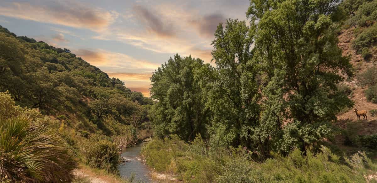
The Guadiaro river shapes one of the most important valleys in the Serranía, creating spectacular gorges such as the Cañón de las Buitreras. It is home to rich riparian flora and varied fauna (foxes, wildcats and birds). Ideal for peaceful walks.
Practical information
- Location: Course of the Guadiaro river (Cortes de la Frontera area)
- Access: Footpaths and recreational areas
- Activities: Hiking and nature observation
- Difficulty: Easy to moderate
- Best time: Spring and autumn
Sierras de Cabrilla and Prieta
Landscape formed during the Jurassic period with characteristic relief of the Baetic cordillera. Great geological value. Less vegetation in some areas but excellent for understanding how the Serranía was formed.
Practical information
- Location: Central area of the Serranía de Ronda
- Access: Footpaths and rural tracks
- Activities: Hiking and geology
- Difficulty: Moderate
- Best time: Spring and autumn
Hidalga-Oreganal and Blanquilla
Transition zone between Ronda and El Burgo with sparser vegetation (scrub and grassland) but important fauna presence. A quiet, little-visited area, ideal for those seeking silence and wide views.
Practical information
- Location: Between Ronda and El Burgo
- Access: Rural tracks and local footpaths (some sections poorly marked)
- Activities: Peaceful hiking and wildlife watching
- Difficulty: Easy to moderate (GPS track recommended)
- Best time: Spring and autumn
Sierra Real and Palmitera
Formed by limestone, dolomite and peridotite. Habitat of Iberian ibex and eagles. Rugged terrain with good panoramic views. An up-to-date track is recommended.
Practical information
- Location: Serranía de Ronda
- Access: Mid-mountain footpaths
- Activities: Hiking and wildlife watching
- Difficulty: Moderate (experience recommended)
- Best time: Spring and autumn
Valle Sijuela and Tajo del Abanico
Deep gorge formed by the erosion of the Sijuela stream, with caves and curious rock formations such as the “Tajo del Abanico”. Wild and little-visited landscape. An up-to-date GPS track is recommended.
Practical information
- Location: Serranía de Ronda area
- Access: Local footpaths (poorly marked in places)
- Activities: Hiking and landscape photography
- Difficulty: Moderate (track recommended)
- Best time: Spring and autumn
Las Navetas – Sierra de Carrasco
Area of high environmental interest with dehesa oak woodlands. Notable for its population of raptors (booted eagle, short-toed eagle, eagle owl, Egyptian vulture) and mammals such as the wildcat. An excellent spot for birdwatching.
Practical information
- Location: Between Subbaetic carbonate materials
- Access: Footpaths and tracks
- Activities: Birdwatching and hiking
- Difficulty: Easy to moderate
- Best time: Year-round
Sierra Sanguijuela Salinas
A 3,150-hectare area on the outskirts of Ronda with great variety of flora and fauna. Very suitable for hiking with multiple route options.
Practical information
- Location: On the boundary of the Ronda municipality
- Access: Multiple footpaths and access points
- Activities: Hiking and nature observation
- Difficulty: Variable (easy to moderate)
- Best time: Spring and autumn
Tajo de Lagarín
Area with carob trees and holm oaks. In the lower zones there are traditional almond and vineyard cultivations. A mixed landscape of Mediterranean scrub and mountain agriculture.
Practical information
- Location: Serranía de Ronda area
- Access: Tracks and local footpaths
- Activities: Hiking and rural landscape photography
- Difficulty: Easy
- Best time: Spring and autumn
Colina de Tavizna and Cueva del Hundidero
Jurassic formations with geological and archaeological value. The Cueva del Hundidero contains prehistoric remains. An interesting area, though access may require an up-to-date track.
Practical information
- Location: Karst area of the Serranía
- Access: Local footpaths (check current condition)
- Activities: Hiking, geology and archaeology
- Difficulty: Moderate
- Best time: Spring and autumn
Garganta del Cupil
A spectacular gorge covered in dense holm oak and cork oak forest. A cool, shady environment even in summer. A good place for walks in the shade.
Practical information
- Location: Serranía de Ronda
- Access: Local footpaths
- Activities: Forest walking
- Difficulty: Easy to moderate
- Best time: Year-round, especially summer
Alcornocal de Bogas Bajas
An important cork oak forest between Ronda and Montejaque. It represents the typical habitat of the Andalusian Mediterranean mountains with great ecological value. Ideal for peaceful walks.
Practical information
- Location: Between Ronda and Montejaque
- Access: Tracks and local footpaths
- Activities: Hiking and environmental education
- Difficulty: Easy
- Best time: Year-round
Important note: Information on access, difficulty, trail conditions and regulations is indicative and may change due to weather conditions, maintenance or temporary rules.
We recommend checking up-to-date tracks and recent reviews on
Wikiloc,
the Junta de Andalucía Visitor Window,
the Nature section of the Diputación de Málaga and
the Gran Senda de Málaga before undertaking any route.
How to get to the Serranía de Ronda
The Serranía de Ronda lies approximately 60–90 minutes by car from Málaga city and between 50–70 minutes from the Costa del Sol (Marbella). The best base is usually the town of Ronda, from where most of the natural areas are easily reached via regional roads and footpaths. Having your own vehicle or a hire car offers the greatest flexibility for combining several sites in one day.

Car hire: the most flexible option
Explore the Serranía de Ronda at your own pace. From Ronda you can comfortably reach the trails of the Sierra de Líbar, the Genal Valley, the Cañón de las Buitreras or the pinsapo of La Escalereta. The regional roads offer spectacular views.
Book car hire in Málaga

Taxi or private transfer: comfort from wherever you are
Enjoy a comfortable and direct private transfer from your hotel in Málaga, the Costa del Sol or Málaga Airport to Ronda or the main entrances to the trails of the Serranía. Ideal for families or if you prefer to relax.
Book taxi or transfer
*No credit card details or advance payment required. We recommend booking in advance.
Other transport options
You can reach Ronda by train (Renfe from Málaga María Zambrano) or regular bus. Once in Ronda, local taxis or guided tours are good options for accessing some trails. For long-distance hiking, the Great Trail of the Serranía de Ronda (GR-141) connects many of the natural areas. However, for visiting several dispersed sites, a hire car remains the most practical solution.