- Albufera — a coastal lagoon, cut off from the sea or only loosely joined to it. Adra has the one on this road.
- Sabinar — a wood of sabina, a juniper that holds dunes. Punta Entinas is the example.
- Rambla — a dry river bed that only runs after a storm. They cut the Almeria shore.
Mediterranean coast — from the Guadalhorce to Cabo de Gata
This is the shore road east of Malaga: river mouth, cliffs, subtropical terraces, a lagoon, salt flats and a volcanic cape. It is not one resort. The A-7 and the old N-340 run parallel; the interesting water is usually a turn off the dual carriageway.
Start at the Guadalhorce, where migrating birds still drop after the Strait. Then the cliffs of Maro and Cerro Gordo, the bay of La Herradura, the chirimoya country around Almunecar and Motril, the Albufera of Adra, Punta Entinas, Almeria city and Cabo de Gata. Related pages: Malaga, Granada, Almeria, Maro cliffs.
*In summer the N-340 crawls through the towns. Start early if you want the cape in daylight.
Words you will meet
Malaga and the Guadalhorce
The route leaves the city at the mouth of the Guadalhorce, west of the airport. The river has been boxed and farmed, but the remaining wetland is still a pause for birds crossing the Strait. You come for the hides and the sky, not for a wild delta. Sugar cane used to stand here as a hint of the tropical strip further east; most of those fields have gone. The hills behind the city are the Montes de Malaga — a different day, inland pine, not the shore.
Nerja, Maro and Cerro Gordo
East of the Axarquia the coast stands up. The protected cliffs of Maro and Cerro Gordo drop into coves that the dual carriageway never sees. Gulls use the rock; the water is clear enough that people stop for that alone.

Nerja is the town on the Malaga side of the provincial line. The Balcon de Europa is a stone balcony over the sea — useful, busy, and the photograph everyone takes. Walk it once, then take the old road through Maro if you want the cliffs.

La Herradura and Almunecar
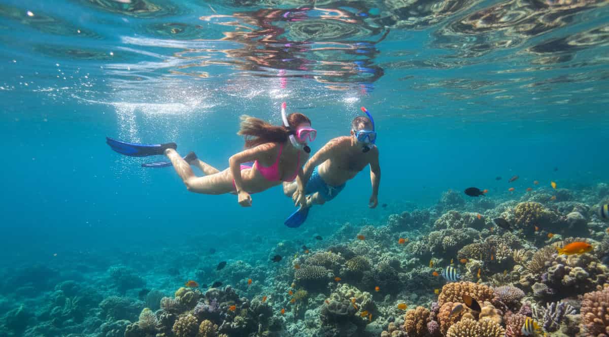
La Herradura is the horseshoe bay after the cliffs. The water is sheltered and often clear enough to snorkel close to the rocks. Past the bay the hills are terraced for chirimoya (custard apple), avocado, mango and some papaya — the subtropical belt of the Granada coast, with Motril in the same valley system.
Almunecar keeps a Phoenician and Roman past under a later town, a castle of San Miguel on the rock, and an old centre that still works as a market town rather than only a strip of apartments.
This is also the bottom of the mountain road from Granada via Otivar, if you came the other way.
Adra and Punta Entinas
Once you cross into Almeria the plastic greenhouses begin. The stop that is not plastic is the Albufera of Adra, a lagoon of real use to waterbirds on this dry coast. Adra town has a harbour, a paseo and Civil War shelters if you like that layer. The lagoon is the reason this page includes the town.
Further on, before Roquetas thickens, Punta Entinas-Sabinar is dune, salt pan and sabina juniper. Audouin’s gull and other coastal species use it. The salt flats are the look: white, shallow, working. Roquetas itself is the resort; the reserve is the turn before you accept the promenade.
Almeria and Cabo de Gata

Almeria city sits in a dry bay with the Alcazaba above it — the tenth- and eleventh-century fortress that still reads as the main monument. The old streets below are a short walk. The beaches close to town are useful, not wild.

Cabo de Gata-Nijar is the end of the road in the useful sense: a volcanic natural park, dry, with coves and a lighthouse. Monsul is the pale beach Spielberg used for the tank scene in Indiana Jones and the Last Crusade. San Jose and the other white villages are the bases. You need time and a car that can take dirt tracks if you want the last coves. It is not an add-on after lunch in Nerja.
How to follow the coast
The A-7 is the fast spine. The old N-340 still threads the towns and the viewpoints. Cabo de Gata leaves both. From the Costa del Sol you are already on the road; Almeria city is a couple of hours east of Malaga if you do not stop, a full day if you do.

Car hire: the flexible option
The way to leave the A-7 for Maro, the Albufera and the last tracks in Cabo de Gata, and still get back along the shore.
Hire a car at Malaga Airport
Taxi or private transfer
From Malaga Airport to a hotel in Nerja, Almunecar or Almeria. A same-day run to the cape from the Costa is tight. Stay the night in San Jose if that is the point.
Book a transfer*No credit-card details or advance payment are needed to request a quote. Cancellation is free. Book ahead in high season to avoid price rises and to secure the car or group size you need.
Other options
Buses and trains follow the coast to Almeria. They serve Nerja, Motril and Adra. They will not drop you at Punta Entinas or a dirt cove in Cabo de Gata.
Practical tips
- Treat this as two days if Cabo de Gata is the point. Malaga to Nerja and Almunecar is already a full coastal day. Adding the cape the same afternoon means you see it in the dark.
- Use Nerja for the Balcon de Europa and a walk in town. Use the old road through Maro for the cliffs and the cove beaches — that is the landscape, not the balcony.
- La Herradura is the place to get in the water if you want a sheltered bay. Further east the interesting stops are birds and salt, not another swim.
- Pack binoculars for the Guadalhorce mouth, the Albufera of Adra and Punta Entinas. Those reserves look empty without them.
- Cabo de Gata is dry and exposed. There is little shade and few petrol stations once you leave Almeria or San Jose. Fill up the car and take drinking water before you enter the park.
- Monsul is a protected beach inside the park. In high summer the access road is often controlled or closed to extra cars. Arrive early, or walk in from the signed car parks.
Frequently asked questions about the Mediterranean coast route
How long is the drive from Malaga to Cabo de Gata?
About two and a half hours on the A-7 with no stops. With Maro, Almunecar and Adra it is a full day, and the cape still wants another morning.
Where are the tropical crops?
On the Granada coast around Almunecar and Motril: custard apple, avocado and mango on the terraces behind the shore.
Was Indiana Jones filmed here?
The beach with the tank in The Last Crusade is Monsul, in Cabo de Gata. The desert chases are inland at Tabernas, not on this shore road.
Is Cabo de Gata a city beach?
No. It is a dry volcanic park with coves and dirt tracks. San Jose is the usual base.
Where should I stop for birds?
The Guadalhorce mouth near Malaga, the Albufera of Adra and Punta Entinas. Cabo de Gata has its own list, more marine than marsh.
Do I need a car?
You can bus the towns. You need a car for Maro’s coves, Punta Entinas and the last beaches of the cape.