Granada offers a wide variety of hiking routes, ranging from family-friendly and accessible paths to more demanding trails that require experience and stamina. There are routes for exploring the city on foot, as well as options that can be enjoyed by bicycle, motorbike, on horseback, or in an off-road vehicle.
Discover the hiking trails in Granada with stunning mountain views
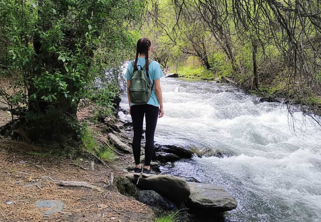
These paths traverse the Sierra Nevada National Park, the Alpujarra region, and the Costa Tropical, linking places such as Almunecar. Granada is therefore a top destination for hikers in Andalucia, attracting those seeking trails in the Sierra Nevada or guided excursions through its mountains.
Highlights include river valleys, gorges, and villages with traditional architecture, making it easy to combine walks with cultural visits across the province of Granada.
History of Hiking Routes in Granada
Many hiking routes in Granada follow historic paths, such as 19th-century mining tracks or Moorish irrigation channels in the Sierra Nevada. For instance, the Vereda de la Estrella was built to connect mines in the Genil valley, while trails in the Alpujarra retain Moorish traces.
During the Moorish period, these paths supported trade and irrigation; today they blend nature and history. In the 20th century, with the creation of protected areas, they were revived for tourism, establishing Granada as a leading hiking destination in the Sierra Nevada.
Recommended Hiking and Walking Routes in Granada
Granada boasts an extensive selection of hiking trails with varying levels of difficulty. Below is an overview of some of the most rewarding routes, including details on length, duration, and key features to help plan your hike in Granada.
Vereda de la Estrella: Gentle trail in the northern Sierra Nevada, ideal for beginners.
Ascent to Morrón Sanjuanero from La Ragua: Moderate route with panoramic views.
Walking through Granada: Easy urban walk through historic districts and viewpoints.
Río Verde Descent: Adventurous water gorge with canyoning elements.
Monachil Route: Moderate path along the river with hanging bridges and tunnels.
Poqueira Villages Route: Family-friendly walk through Pampaneira, Bubion, and Capileira with preserved Moorish architecture.
Details of the Vereda de la Estrella
The historic Vereda de la Estrella – a highlight for hikers in Granada
This late-19th-century path once linked mines in the Genil valley and is now an easy trail into the northern Sierra Nevada. Starting in Guejar Sierra near the Restaurante San Juan (with parking available), the 21-kilometre route takes around 6 hours – perfect for a full day of hiking in Granada.
Tip: Carry plenty of water and sturdy footwear – the ground can become slippery after rain.
Ascent to Morrón Sanjuanero from La Ragua
Moderate 8-kilometre route requiring about 5 hours. In snowy conditions, crampons and poles are recommended. The trail offers expansive views across the sierra and connects to other Sierra Nevada routes.
Walking through Granada: Urban Route
From the car park at Plaza de San Agustin, the route passes Plaza Nueva, Acera del Darro, and Paseo de los Tristes, climbing to the Alhambra via Cuesta de los Chinos. It continues to the Palacio de Carlos V, the Albaicin, and the viewpoints of San Cristobal and San Nicolas before returning to the start. Covering 9 kilometres, it takes under 4 hours – ideal for discovering Granada on foot.
Note: Avoid the hottest midday hours; mornings or late afternoons are more comfortable.
Río Verde Descent: Water Adventure
This route follows the Río Verde through the Almijara mountains, reaching the sea at Almunecar on Granada's Costa Tropical. It provides immersive nature experiences with opportunities to swim in natural pools.
Highlights: Lush landscapes, natural pools, waterfalls, narrow gorges, mountain vistas, diverse flora and fauna including birds of prey and ibex.
Practical details: The full route lasts 7 hours; a family version takes 2.5 hours. Minimum group size of 7 for safety. Intermediate difficulty for the complete route, suitable from age 8 in the shorter version. Equipment and professional guides included.
Canyoning – descending gorges – combines jumps, abseiling, and overcoming obstacles in river environments, perfect for connecting with nature.
In summary, the Río Verde descent blends adrenaline with breathtaking scenery – suitable for hikers with prior experience in similar activities.
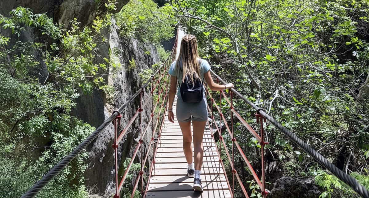
Monachil Route: Gorges and Bridges
Moderate, nearly 10 kilometres long, running parallel to the river in Monachil. Features a hanging bridge, tunnels, and varied terrain, ending with views over the Vega de Granada. Takes about 4 hours, returning along the same path.
Tip: Check the condition of the bridges beforehand, especially after rain.
Alpujarra and Lanjaron Route
Night views of the Alpujarra – an ideal area for hiking
This area in southern Granada is among Spain's most beautiful. Starting in Lanjaron with its thermal baths and bottled water plant, the trail captures the essence of the Alpujarra with varied scenery.
Hoya de la Mora to Refugio Elorrieta
16-kilometre route through the Sierra Nevada National Park to the refuge at 3187 metres, starting at Hoya de la Mora. Takes 6 hours and can be done year-round with appropriate equipment for snow or dry conditions.
Poqueira Villages Route
Family-friendly 7-kilometre trail through Pampaneira, Bubion, and Capileira, preserving Moorish architecture. Starts in Pampaneira, crosses the Río Chiscar after Capileira, and takes 4 hours. Best in spring or autumn.
Note: With children, choose shorter sections to avoid fatigue.
Activities Related to Hiking in Granada
Beyond traditional walks, Granada offers canyoning in the Río Verde or visits to Alpujarra villages. These complement the experience in the Sierra Nevada and Costa Tropical.
Canyoning: Navigate gorges with jumps and waterfall descents.
Guided tours: Explore with experts on routes like Los Cahorros de Monachil.
Horseback rides: Discover the Alpujarra on horseback, suitable for beginners.
Mountain biking: Cycle easy trails through the Vega.
Wildlife watching: Spot ibex on ascents like Morrón Sanjuanero.
Thermal baths: Relax in Lanjaron after an Alpujarra hike.
The Alpujarra and Poqueira Villages: The Heart of Hiking
The Alpujarra in southern Granada is one of Spain's most scenic hiking regions. Villages such as Pampaneira, Bubion, and Capileira retain Moorish architecture and are linked by paths crossing rivers and gorges.
These family-oriented routes allow you to experience both history and nature.
Water Routes and Canyoning in Granada
For variety, water routes like the Río Verde descent combine hiking with adventure elements. This gorge in the Almijara offers waterfalls and pools, reaching the Costa Tropical.
Other options include the Gollizno in Moclin, with walkways over river gorges suited to different abilities.
How to Reach Granada for Your Hiking Trips
Granada, with its network of trails in the Sierra Nevada and Alpujarra, is best accessed from Malaga Airport (around 130 km away). The main route is the A-92 motorway, leading to starting points like Guejar Sierra or Monachil. For scattered routes, flexible transport options are recommended.
Car Hire: Flexible Access to Trails
Hire a car at Malaga Airport and reach Granada in 1.5 hours via the A-92, giving you independence to visit routes like the Vereda de la Estrella or the Alpujarra. Ideal for parking in Guejar Sierra or Hoya de la Mora and exploring the Costa Tropical.
A taxi from Malaga Airport takes you to Granada in 1.5 hours, straight to your accommodation near trails like the Poqueira villages. Perfect for relaxing after your flight and focusing on hiking without logistical worries.
*No need to enter credit card details or pay in advance. We recommend booking early to secure the best prices and availability.
Other Transport Options for Hiking in Granada
Direct buses from Malaga Airport reach Granada bus station in 2.5 hours, providing access to urban or nearby routes. Local taxis can take you to points like Lanjaron. See details on the airport page.
Route from Malaga Airport to Granada to start your hiking
Tourist Information for Hiking in Granada
Granada Tourist Office: Plaza Mariana Pineda, 10, 18009 Granada.